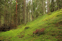
Esker.
Eskers are casts of sub-glacial tunnels or ice-walled canyons near to an ice margin. Meltwater in glaciers may collect to flow through networks of large tunnels and the water is often highly charged with debris. Where and when velocity falls then sediment may be laid down on the floor of the tunnel. If a tunnel becomes blocked by sediment or ice fall then water and sediment is ponded behind the blockage. If the tunnel is developed on the base of the ice then the sediments in the esker will be preserved with little disturbance. In contrast, if the tunnel lies within the ice then the sediments will be considerably disturbed as the ice melts and the thread of sediment is let down on the valley floor. On valley floors, the eskers lie within former ice margins marked by moraine systems, indicating that these ridges form beneath glaciers. Eskers are aligned parallel to former ice flow. In a valley, an esker will be orientated down-valley and this is one way to distinguish this landform from any moraine ridges running across the valley floor. |
Kame Terrace.
A kame is a geological feature, an irregularly shaped hill or mound composed of sand,gravel and till that accumulates in a depression on a retreating glacier, and is then deposited on the land surface with further melting of the glacier. Kames are often associated withkettles, and this is referred to as kame and kettle topography. With the melting of the glacier, streams carry sediment to glacial lakes, building kamedeltas on top of the ice. However, with the continuous melting of the glacier, the kame delta eventually collapses on to the land surface, furthering the "kame and kettle" topography. Kame terraces are frequently found along the side of a glacial valley and are the deposits ofmeltwater streams flowing between the ice and the adjacent valley side. These kame terraces tend to look like long flat benches, with a lot of pits on the surface made by kettles. They tend to slope downvalley with gradients similar to the glacier surface along which they formed, and can sometimes be found paired on opposite sides of a valley. |
Drumlin.Drumlins and drumlin clusters are glacial landforms, composed primarily of glacial till, which have been extensively studied. Geologists have proposed several theories about their origin. They are formed a short distance within the receding glacier ice and record the final direction of ice movement.[2] Drumlins occur in symmetric, spindle, parabolic, and transverse asymmetrical forms. Drumlins are commonly found with other major glacially-formed features and are related on a regional scale to these landforms. The large-scale patterns of these features exhibit spatial organization of the drumlin-forming flows with related tunnel valleys, eskers, scours, and exposed bedrock erosion
|
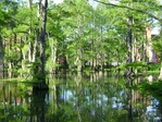
Swamps.
Large bottomland swamps are common landforms in the forests of eastern and southern North America, forming their own unique deciduous ecosystems in poorly-drained areas, notably the floodplains of big rivers. Rivers create floodplains through regular over-topping of their banks, depositing rich sediments in the low valley shouldering their usual channels. Some of the trees in bottom-land swamps, such as water tupelo, sweetgum and the deciduous conifer called bald-cypress, may grow to immense proportions. |
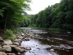
Rivers.
A river is a natural watercourse,[1] usually freshwater, flowing towards an ocean, alake, a sea, or another river. In a few cases, a river simply flows into the ground or dries up completely at the end of its course, and does not reach another body of water. Small rivers may be called by several other names, including stream, creek, brook, rivulet, and rill. There are no official definitions for generic terms, such as river, as applied to geographic features,[2] although in some countries or communities a stream may be defined by its size. Many names for small rivers are specific to geographic location; examples are "run" in the United States, "burn" in Scotland and northeast England, and "beck" in northern England. Sometimes a river is defined as being larger than a creek,[3] but not always: the language is vague.[4] |
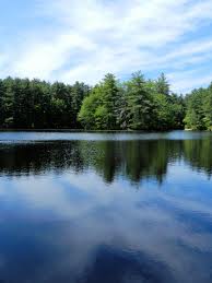
Ponds.The topmost zone near the shore of a lake or pond is the littoral zone. This zone is the warmest since it is shallow and can absorb more of the Sun’s heat. It sustains a fairly diverse community, which can include several species of algae (like diatoms), rooted and floating aquatic plants, grazing snails, clams, insects, crustaceans, fishes, and amphibians. In the case of the insects, such as dragonflies and midges, only the egg and larvae stages are found in this zone. The vegetation and animals living in the littoral zone are food for other creatures such as turtles, snakes, and ducks.
|
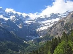
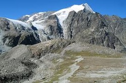
Mountains.
A mountain is a large landform that stretches above the surrounding land in a limited area usually in the form of a peak. A mountain is generally steeper than a hill. Mountains are formed through tectonic forces or volcanism. These forces can locally raise the surface of the earth by over 10,000 feet (3,000 m). Mountains erode slowly through the action of rivers,weather conditions, and glaciers. A few mountains are isolated summits, but most occur in huge mountain ranges. High elevations on mountains produce colder climates than at sea level. These colder climates strongly affect the ecosystem of mountains: different elevations have different plants and animals. Because of the less hospitable terrain and climate, mountains tend to be used less for agriculture and more for resource extraction and recreation, such as mountain climbing. |
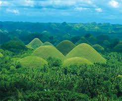
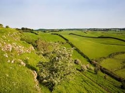
Hills.A hill is a landform that extends above the surrounding terrain. Hills often have a distinct summit, although in areas with scarp/dip topography a hill may refer to a particular section of flat terrain without a massive summit
|
